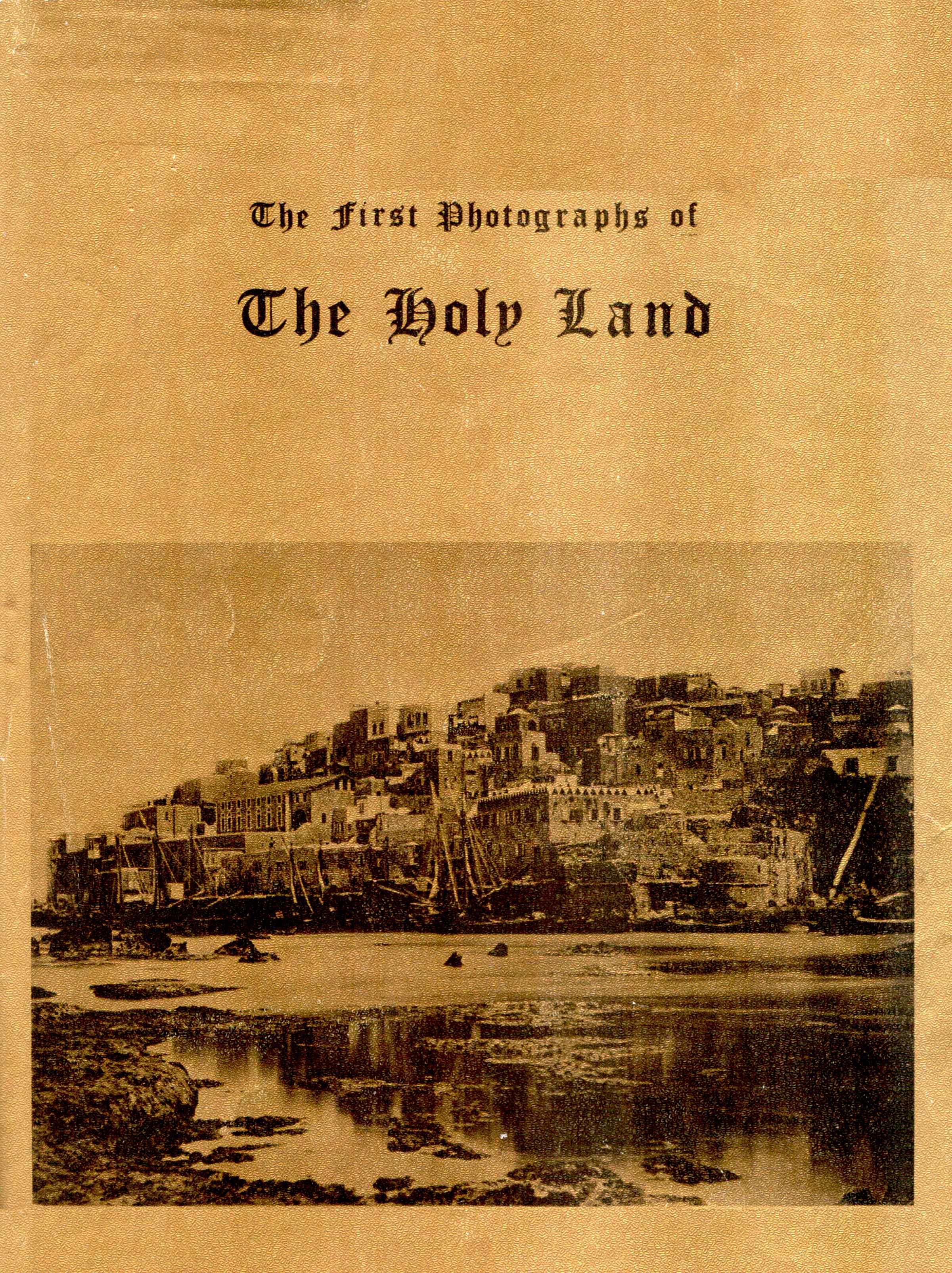
First Photos of the Holy Land
Introduction
The first
British
Governor,
Herbert
Samuel
writing in the Interim Report on the Civil Administration
of Palestine to the League of Nations, June 1921, entitled "On
the Condition of Palestine after the War" relates that "There are
now
in the whole of Palestine [what is today the State of Israel and the
State
of Jordan] hardly 700,000 people".
Today
there are 6
million
Jews and 4.5 million Arabs in Israel, the West Bank and Gaza alone, not
counting Jordan.
These
pictures
illustrate
without a doubt that there was massive Jewish and Arab immigration into
Israel: The Jewish refugees fleeing religious and ethnic persecution
from
European and Arab States, and Arabs immigrants from Syria, Egypt,
Jordan,
and Iraq. These were not native "Palestinians" as they are called
today,
rather Arab migrant workers looking for a better standard of living.
This
story is brought to life in the following pages in over 460 photographs
and lithographs of the period.
The Holy Land in the 19th
Century
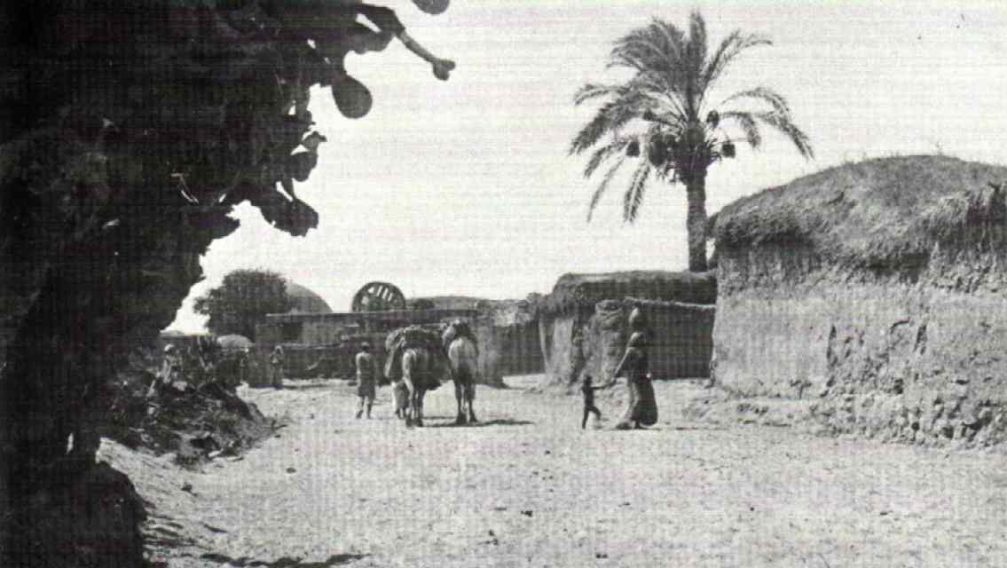
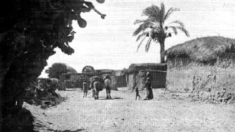 Arab
Settlement Near
Tel-Aviv, 1911
Arab
Settlement Near
Tel-Aviv, 1911
|
The Holy Land
was a poor,
largely
deserted country during the 19th century. Its inhabitants were
backward,
its services meagre, its roads of poor quality and unsafe, and its
economic
activity was very limited. Robbery and assault were everyday
occurrences.
There were no medical services of any kind and plagues frequently took
a heavy toll of life. The population dwindled gradually: entire
villages
were abandoned and cities became small towns with few inhabitants.
Aside
from Gaza and Jerusalem, each town in the Holy Land (up to the 1840's)
had a populace of less than ten thousand. The deterioration of the
country
was a result of the negative development in the Ottoman Empire which
underwent
intensified internal decline from the XVIIth century and on. This fact
left its impact on Palestine: the local governors became more corrupt,
and neglected their obligations, the troops were beyong control and the
Bedouin tribes from the desert broke into cultivated areas, turning
vast
sections into wilderness. As a result, disorder and insecurity spread,
government construction and public works were neglected, agriculture
and
trade were severely damaged and the farmers were oppressed and
impoverished.
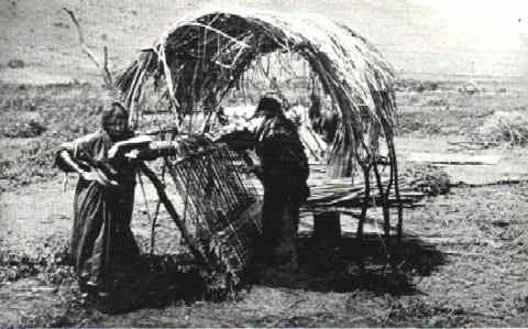 Weaving
Reed
Mats near
Tiberias, 1894
Weaving
Reed
Mats near
Tiberias, 1894
|
The majority
of the
population
was rural but even the urban residents earned their livelihood from
agriculture.
Some 600 of the country's 700 villages were located in the mountains,
while
the plains and valleys were largely abandoned, being swampy and
infested
with malaria. The only settlements in the valleys were situated at the
foot of the mountains where they were less exposed to malaria and
Bedouin
attacks.
In 1831
Ottoman rule
was
interrupted by Muhammad 'Ali, who occupied Palestine and Syria until
1840.
A new era began which was characterized by political and social reform
aimed at centralizing control of the country, modernizing the
administration
and granting equal rights to non-Muslim minorities. The country was
opened
for the first time to widespread political, cultural and economic
activity
by the European powers. These new developments continued after the
Ottoman
rule was resumed in 1840-41. During the second half of the nineteenth
century
direct Ottoman control was gradually consolidated in all parts of the
country,
Bedouin attacks were checked, general security increased, the
oppression
of the urban population was eased to a considerable extent, and the
involvement
of the European powers expanded greatly. These developments brought
about
certain improvements in the country's economy and in the conditions of
the inhabitants.
Jews of the Holy Land in
the 19th Century
The Jews were
concentrated
mainly
in the four "Holy Cities": Jerusalem, Safed, Tiberias and Hebron. By
and
large, the Jews were regarded as second-class citizens of the Ottoman
Empire.
They encountered legal discrimination at every turn, and evidence given
by them was not recognized by the courts. Jews were debarred from
attaining
high government office. They were subject to daily mockery and scorn,
were
forbidden to ride camels or horses within the city limits, and were
obliged
to make way for Moslems. Their persons and possessions were unprotected
by law and prone to constant abuse (without any possibility of
appealing
to the courts of justice). M. Reisher, who lived in Jerusalem, writes
in
1866:
"When a Jew
walked among
them in the market, one would throw a stone at him in order to kill
him,
another would pull his beard, and a third his ear-lock, yet another
spit
on his face, and he became a symbol of abuse".
Although
their principal
source
of income was the "Haluka" (financial support from abroad), heavy taxes
were imposed on them by the Turkish authorities. Subsequent to the
Crimean
War (1853-1854), there was a gradual improvement in the predicament of
the Jews, mainly as the result of the protection granted them by the
consuls
in certain cases. In any event, they continued to be second-class
citizens
reliant on the clemency of the ruling authorities and the Moslem
population.
From the 1840's the Jewish community grew considerably through new
waves
of immigrants, mainly from Russia. In the 1880's the Jewish population
was further augmented by refugees and agricultural settlements which
were
founded in many parts of the country. Jewish urban centers
(particularly
in Jerusalem, Jaffa and Haifa), developed as well.
The
Landscape of the Holy
Land
in the 19th Century
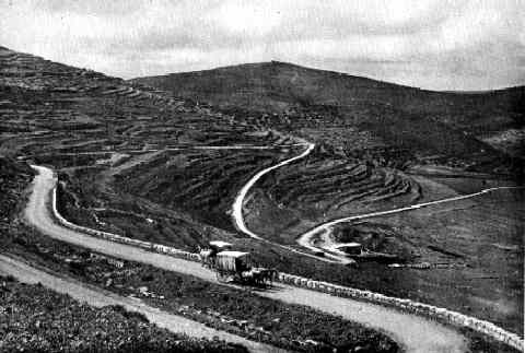 On
The Main
Road From
Shechem To Jerusalem, 1913
On
The Main
Road From
Shechem To Jerusalem, 1913
|
The views
unfolding before
the
eyes of visitors to the Holy Land in former times differed from those
seen
today. To a large extent the landscape was one of desolation and ruin,
swamps and uncultivated wilderness, with a sparse and backward
population
living mainly in small settlements. The most prominent changes have
occurred
in the coastal plain and the valleys of the interior, the greater parts
of which were formerly covered by swamps and sparsely settled by
Bedouins
and poor Arab peasants. Today, these are the most highly populated and
prosperous regions of Israel. The Sharon and certain areas of Samaria
and
Judea were partly afforested in those days[1]. On the other hand,
visitors
to the Holy Land found its scenery far more reminiscent of the Biblical
world than is the case at present. This also applied to the day-to-day
life of its inhabitants and their various occupations, the latter
having
undergone but minor changes from ancient times to the 19th century.
Animals
were still being used for ploughing and threshing, flour was ground by
millstones as in days of yore, water was brought from the wells in
jugs,
camel caravans made their way along the roads, women bore bundles of
kindling
on their heads. All these scenes created the impression of a remote and
enchanted world whose association with the Biblical world was
inevitable.
They were often captured for posterity by the lens of the camera. Today
these photographs frequently serve as the sole evidence of a
way-of-life
and culture which within a single generation will belong wholly to the
past.
[1] The
map of the
Palestine
Exploration Fund (1880) demarcates two large oak forests in the Sharon.
One of these forests began west of Karkur, while the other extended
southward
from the Crocodile River almost to the Yarkon River. Some old trees of
the former forest still stand west of Benyamina and near Pardess Hanna.
No tall trees of the second forest have survived but a considerable
area
of old stump growth may still be seen.
Towns of
the Holy Land
in the
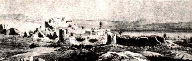
19th Century
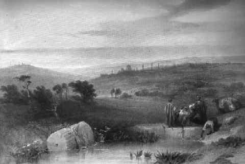 Jerusalem
from what
is now "East Jerusalem", by David Roberts, 1842
Jerusalem
from what
is now "East Jerusalem", by David Roberts, 1842
|
Few of the
urban areas of
the
Holy Land during the 19th century would measure up to present-day
criteria.
They were merely large villages or small towns. Even in the "large"
cities,
such as Acre and Jerusalem, the population did not exceed 10,000. For
reasons
of defense, some of the towns were surrounded by walls, but towards the
middle of the 19th century the latter ceased to be functional (the
walls
of Safed and Tiberias were destroyed by the earthquake of 1837). Only
Jerusalem
and Acre were considered to be fortified cities.
The towns
were very
densely
built up and were unable to expand beyond their walls until the
mid-19th
century because of the Turkish security regulation, prohibiting
construction
within 850 metres of the city limits. A more liberal approach became
manifest
only in the latter half of that century when the security situation
improved
and the influence of the new era began to be felt.
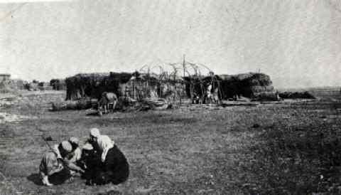 Arab
Settlement in Jezreel
Valley, 1910
Arab
Settlement in Jezreel
Valley, 1910
|
Most of the
towns were
characterized
by an absence of planning, dark, narrow, winding, unpaved alleys, open
sewage canals, and small gloomy shops. The majority of the houses, with
the exception of those in Jerusalem, Hebron and Nablus, were built of
mud[2].
Cultural
life and
entertainment
were totally lacking in the towns, and the latter boasted no avenues,
squares,
broad streets or public buildings. At sunset the gates of walled cities
such as Jerusalem were shut and all late-comers were obliged to spend
the
night outside.
The
markets (bazaars)
played
a key role. They were very picturesque and aroused the wonderment of
pilgrims
who flocked to photograph them, in particular the markets of Jaffa,
Jerusalem
and Bethlehem, as mementos of their visit to the Holy Land. These
markets
served not only for the sale of goods but were also the place where
most
of the artisans practised their crafts. There were special markets for
the various craftsmen and merchants: metalworkers, tanners, oil
vendors,
butchers, etc. In certain markets (mainly those in the principal
towns),
fellaheen offered their produce for direct sale. Thus, there were
special
livestock markets in Jerusalem (in the Sultan's Pool) and Jaffa, while
Safed had a market for grain and charcoal.
During the
19th century
the
economy of the towns of the Holy Land was largely based on agriculture.
Their inhabitants owned fields and orchards in the vicinity and the
more
affluent among them gained their livelihood by exploiting the labour of
the fellaheen.
[2]
This was the
situation
up to the mid-19th century. Towards the end of that century gradual
improvements
were introduced.
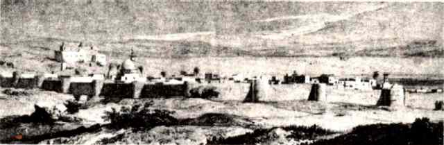
The land
of Galilee
& the
North, Tiberias
 |
The
Milkman in Tiberias,
1858
This
rare photograph
was
taken by the well-known Jerusalem
explorer
E. Pierotti
and
is published here for the first time.
[medium][large] |
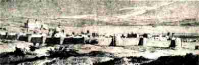 |
Tiberias
before
the earthquake of 1837
[medium][large] |
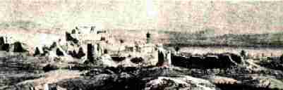 |
Tiberias
after the
earthquake of 1837
[medium][large] |
NEXT
(for
fast internet connections)
NEXT (for
slow internet connections)
Source:
"First Photographs of the Holy Land" by Eli Shiller
Copyright
©
1979,
Eli Shiller. All Rights Reserverd.
Low
grade pictures,
published
with permission.
Not to
be stored in any
retrieval or storage system.
This
page
prepared
by David Hershkowitz